Practical information
ACCESS TO DEPARTURE POINT
Meet Sunday at 11.30 am at Soudara carpark (end of the road), in La Thuile, Italy.
Optional round-trip transfer organized by Altitude Mont-Blanc in a minibus, additional cost to be booked at registration, €60per person.
Meeting point at 9:45am in front of the Chamonix SNCF train station for a 1h15 drive.
If you are driving, there are several free parking spaces in the village of Les Houches, Prarion area. Meeting point at 9:30am in front of the Jacquier bakery at Prarion, Les Houches. You will meet your driver there.
BY TRAIN
From Aosta via Turin or from Chamonix via Paris (Paris Gare de Lyon > Chamonix).
Timetables should be checked with SNCF.
BY CAR
VIA THE COL DU PETIT-ST-BERNARD
If you are coming from the southern half of France, take the A43 motorway to Chambéry, then the A30 to Albertville and continue to Bourg St Maurice. Cross the French-Italian border at the Col du Petit St Bernard (a very good mountain road), then reach the village of La Thuile. At the center of the village, just after the Ruitor bridge, turn right onto the road towards La Joux. Continue to the end of this road where you will find a large car park.
VIA THE MONT-BLANC TUNNEL
From Mâcon or Lyon, take the A40 motorway towards Geneva. As you approach Chamonix, follow signs for the Mont-Blanc Tunnel and Aosta. In Italy, do not take the motorway (green signs), but follow the national road towards Aosta until you reach the village of Pré-St-Didier. Then, turn right towards the Col du Petit-St-Bernard and continue to the village of La Thuile. At the center of the village, just before crossing the river, turn left onto the road towards La Joux. Continue to the end of this road where you will find a large car park.
If you choose the Chamonix/La Thuile transfer option:
Free parking: Several free parking areas in the village of Les Houches, Prarion area. Meeting point at 9:15 AM in front of the Jacquet bakery at Prarion, Les Houches. You will meet your driver there.
Covered parking: Chamonix Park Auto in Chamonix: 04 50 53 65 71.
End point around 4.30pm in La Thuile. Transfer to Chamonix if option chosen (1h15 drive).
Warning: the tunnel may be very busy on Saturday. Think of a little bit more time if you need to book a bus or train from Chamonix.
ACCOMMODATION BEFORE AND AFTER
Chamonix - Hôtel de l’Arve: +33 (0)4 50 53 02 31
Chamonix Tourist Office: +33 (0)4 50 53 00 24
www.chamonix.com
La Thuile, Aosta - Hôtel Le Miramonti : +39 01 65 88 30 84
Pré-St-Didier, Aosta - QC Termemontebianco : +39 02 89 74 72 07
Office du tourisme d'Aoste : +39 01 65 23 66 27
www.aoste.ialpes.com
www.lovevda.it
TO CONTACT US
If you are late please contact the agency as soon as possible on: +33 (0)4 50 79 09 16 or +33 (0)6 42 49 76 07


 7 Days
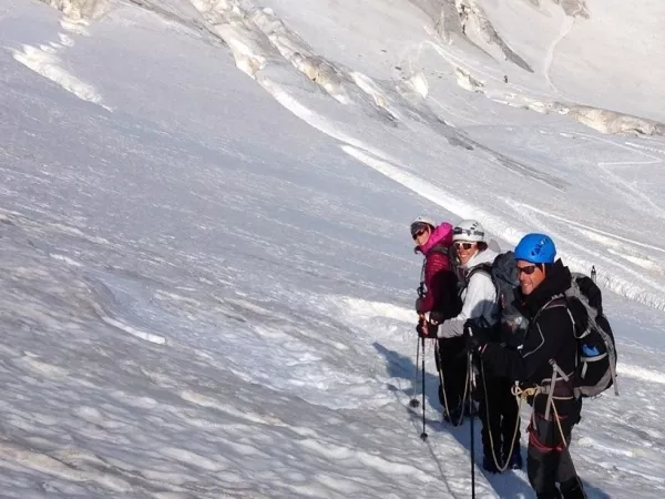
 Guided / with a guide
 With baggage transportation
 Classic (dormitory)
 Level ****
  From 1295 €
 Next departure on 12/07/26