The Grand Paradis National Park in Italy, created in 1922, is a pioneer in the history of mountain natural space protection. It borders, over a large area, its French counterpart, the Vanoise National Park. Together, they offer more than 1200 km² of protected space. Between them, stretches a vast natural barrier, crossed by a few high-altitude passes. A bit more demanding in terms of physical effort and with slightly less comfort, it offers, however, a true immersion in a pristine high-altitude world.
Dates | Status | Prices |
---|
Price upon request for your own group.
The price includes:
The price does not include:
The price is all inclusive from departure to end point.
Personalised tour available
Contact us !Meeting at the Bourg Saint Maurice SNCF train station at 8:30am and transfer to the start of the hike. If you are coming by car, meet at 9:30am at the hiker’s parking lot of Le Fenil, above Sainte Foy Tarentaise.
LE MONAL - COL DU ROCHER BLANC - REFUGE BEZZI
Departure from the classified village of Le Monal, a postcard view of the Massif du Mont Pourri. Ascend through the vast alpine meadow of Plan to the Col du Rocher Blanc (2833m), the border with Italy. An alternative route passing through the Col du Lac Noir, even wilder, is also possible. Descent into the Valgrisenche valley via the Lac de Grapillon, then traverse to the Bezzi refuge. Overnight in the refuge without luggage.
5.5 hour walk / Elevation: +950m -550m
COL BASSAC DERE - REFUGE BENEVOLO
A very beautiful stage that allows you to hike close to the Gliairetta glacier. Ascend to the Col de Bassac Déré at 3083m, with a small optional detour to Tête Traversière if the weather is good. High-mountain atmosphere. Descend the giant scree slope to reach the glacial lake of La Goletta. Photo break... There is still a lovely hour of walking to reach the Edelweiss meadow of Benevolo. Overnight at the refuge in a dormitory, with luggage.
6.5 hour walk / Elevation: +800m -800m
COL BASEY - LACS LIETA - REFUGE SAVOIA
Traverse the alpine meadows, then ascend to the Col Basey at 3160m, on the edge of the imposing glacial cirque of Tsanteleina. A small optional detour to Punta Basei at 3338m is possible. Descend to the Rosset plateau, along the Rosset and Lieta lakes... a dreamlike landscape facing the Grand Paradis! Another incredibly photogenic day! Overnight at the Savoia refuge, without luggage.
5.5 hour walk / Elevation: +980m -680m
COL DU CARRO - REFUGE DU CARRO
Descend to Lago Serru. Then, climb up beneath the pass, through the former glacial bed. The trail is more or less visible in this high-altitude environment, a haven for chamois. After a final ascent, a short section with cables leads to the beautiful plateau of Col du Carro (3122m). Descend by the Lac Noir and Lac Blanc to the Carro refuge, for an overnight stay at 2700m altitude, without luggage.
6 hour walk / Elevation: +900m -750m
REFUGE DU CARRO - SOURCES DE L'ARC - BONNEVAL SUR ARC
Departure off-trail, along the lakes, towards the Col de Pariotes (3034m), which leads to the source of the Arc River. Descend through this wild valley, facing the glacial massif of Albaron, until reaching the village of L'Ecot, listed as one of the most beautiful villages in France. Depending on the group's preference, it is also possible to cross the Col de Gontière and follow the beautiful balcony trail of Plan des Eaux, facing Albaron. Overnight in a guesthouse or hotel in the typical village of Bonneval sur Arc.
5 hour walk / Elevation: +300m -1250m
COL DE BEZIN ET LA ROCHEURE - LA FEMMA
Take the shuttle to the Oulietta. Then, ascend to the Col de Besin (2929m). Traverse the high, wild, and desolate glacial plateau of Méan Martin to reach the Col de la Rocheure (2911m). A quick descent through the alpine meadow leads to the Refuge de la Femma, nestled under its large rock. Overnight in the mountains, without luggage.
6 hour walk / Elevation: +950m -1050m
COL DES PIERRES BLANCHES - COL DE LA LEISSE - TIGNES
Ascend to the Col des Pierres Blanches (2842m) and traverse towards the Vallon de la Leisse. A final slightly wild day, in the vast valleys of Vanoise. Grande Casse and Grande Motte dominate the landscape. And as we must return, descend into the Vallon de Tignes, the end of our hike...
6 hour walk / Elevation: +800m -1050m
End point at 3pm at Tignes and transfer for 4pm at Bourg Saint Maurice.
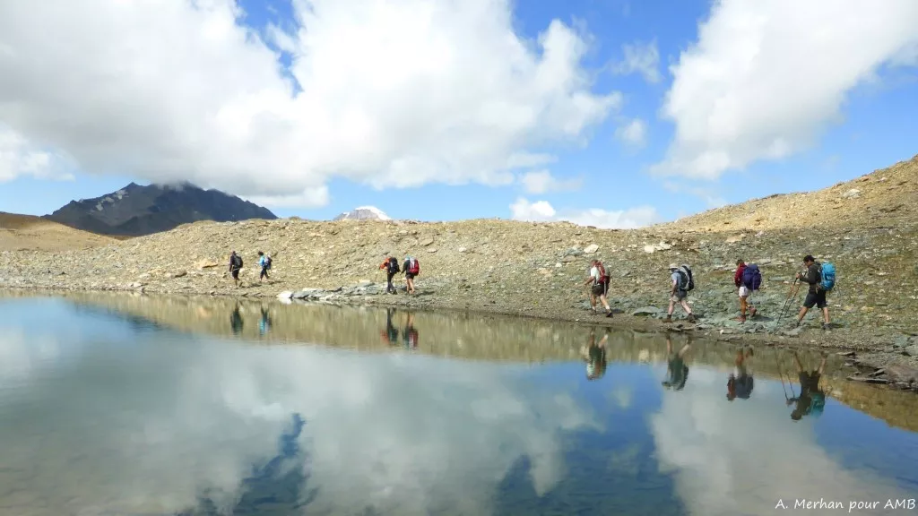
Elevation gain: +/- 900m on average per day
Walking time: 5 to 7 hours per day
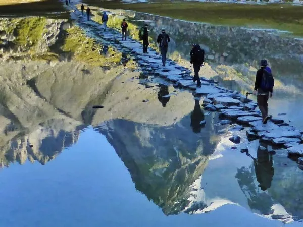
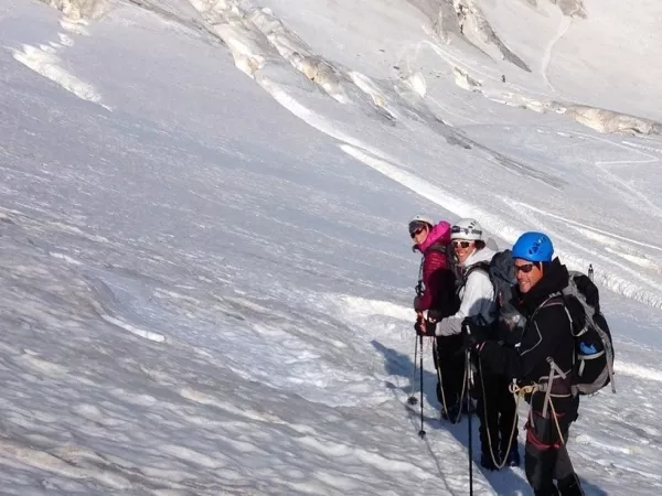
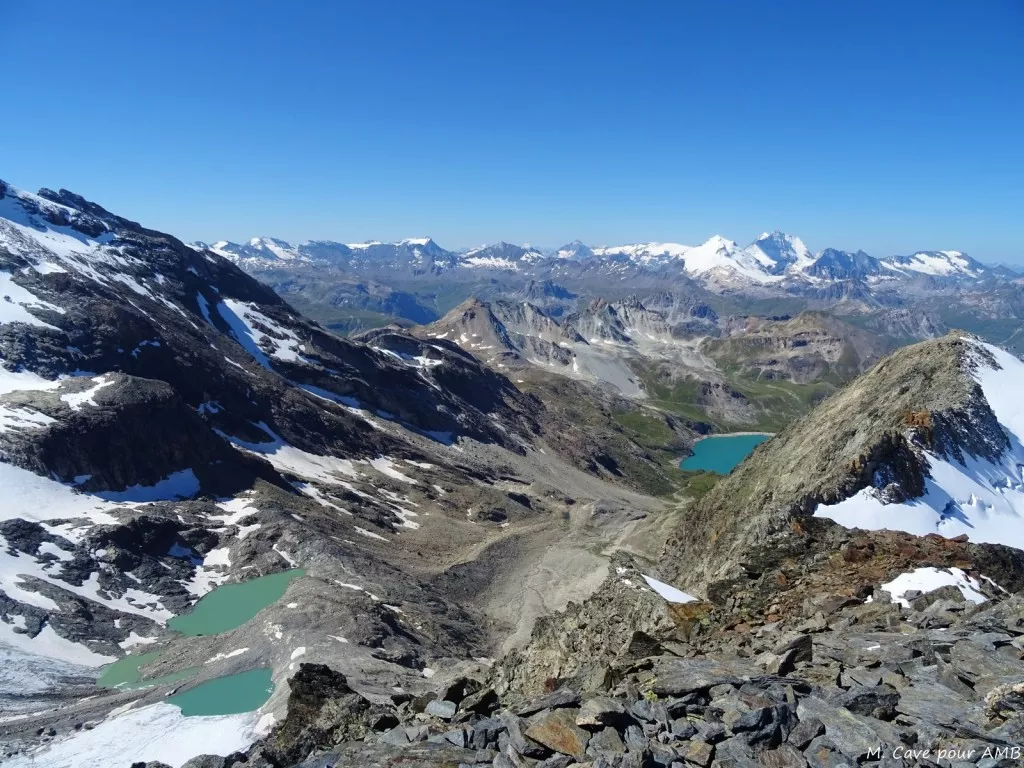
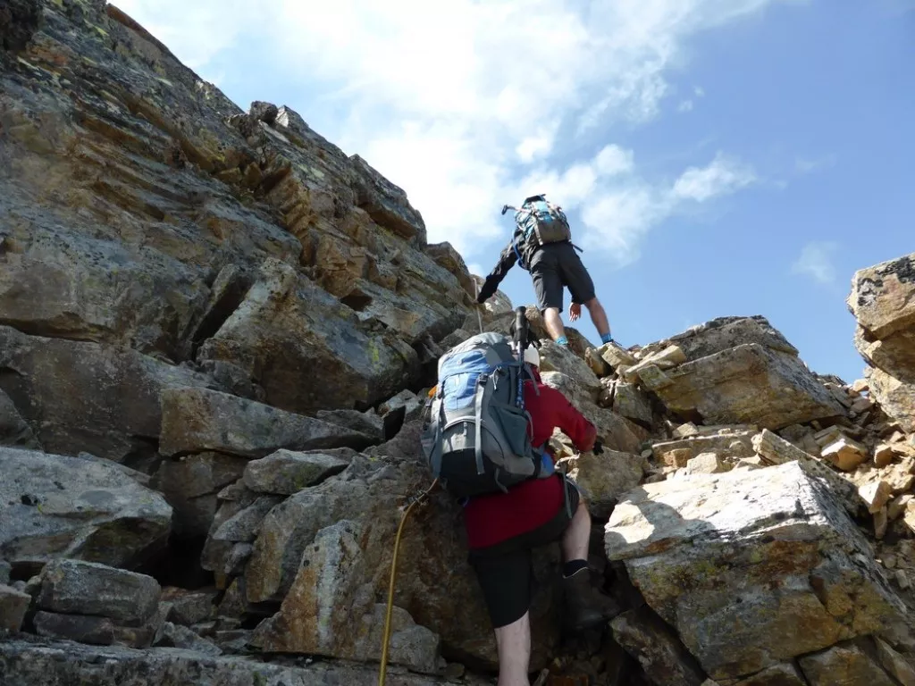
Type of hike: Mountain route with some steep sections. There is an exposed section on day 4, secured with cables. Some parts of the route are off-trail and cross scree fields. Good hiking boots are required.
It is necessary to be in good physical condition and have the mental ability for long efforts. Regular endurance exercise, such as walking, running, or cycling, 6 to 8 hours per week, is recommended. Your physical preparation will make your trip easier and help you enjoy it even more. To learn more about hiking levels, click here: hiking levels.
Number in a group between 6 -14 people supervised by a qualified professional mountain leader. As a thank you, you can give a tip to your guide at the end of the hike, based on your satisfaction. This is not mandatory but is greatly appreciated.
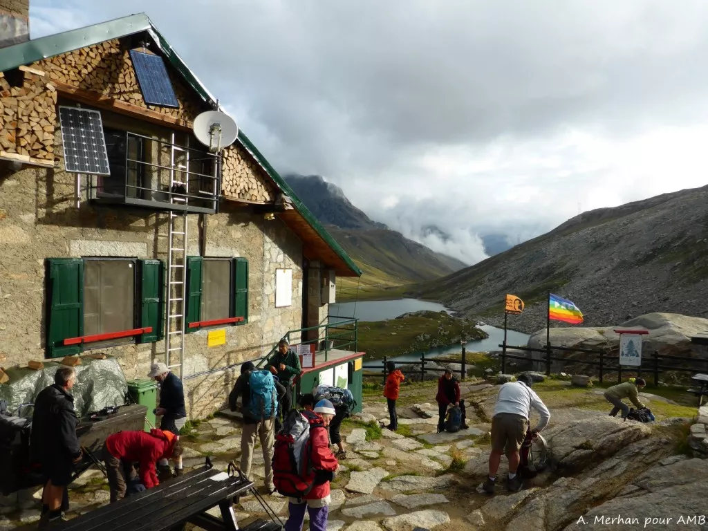
5 nights in a dormitory in a refuge and 1 night in a shared room, in a hotel or guesthouse. All accommodation is equipped with hot showers. However, due to increasingly recurrent periods of drought, access to showers is not guaranteed.
With partial luggage transfer: your luggage is delivered to your accommodation on days 2 and 5.
Breakfast and dinner are provided in each accommodation. Picnics are included and are carefully prepared daily by your mountain leader, comprising a variety of a healthy salads and local products. Please inform us about your food allergies and special diets at the time of booking. We do our best to accommodate special diets (gluten-free, vegetarian, etc.). However, we encourage you to bring some additional products for your own picnics.
IGN Top 25 - 3532 ET - les Arcs, la Plagne and Top 25
3633 ET - Tignes, Val d’Isère (1/25 000)
Istituto Geografico Centrale: map 102 Valsavarenche, Val di Rhêmes, Valgrisenche
Meet Sunday at 8:30 at Bourg Saint Maurice train station. Transfer to departure point.
If you drive, meet at 9:30am at Fenil parking, near Ste Foy Tarentaise.
BY TRAIN
Paris Gare de Lyon > Bourg Saint Maurice. Timetables should must be checked on https://www.oui.sncf/
BY CAR
A430 highway to Albertville, then N90 national road to Bourg-Saint-Maurice. Head towards Tignes - Val d'Isère. Pass the village of Sainte Foy Tarentaise, then the hamlet of La Thuile. Continue for 4.5 km, then take a small road on the left before the avalanche barrier, direction Le Monal, Le Fenil. Park at the hiker’s parking lot in the hamlet of Le Chenal, the meeting point with the group.
End point in Tignes at 3pm, transfer to Bourg St. Maurice arrive at 4pm.
Hotel Arolla, in the center of Bourg Saint Maurice
Hotel l'Angival, in the center of Bourg Saint Maurice
Bourg-Saint-Maurice Tourist Office: +33 (0)4 79 07 12 57
Hotel du Dôme in Tignes les Boisses, next to the lake
If you are late, please contact the agency as soon as possible +33 (0)4 50 79 09 16 or +33 (0)6 42 49 76 07
Clothing
Miscellaneous equipment
Bring a comfortable backpack of 30 to 40 litres for your personal belongings for the day (warm clothes, waterproofs, water, plate and cutlery for your picnic, sunscreen and your identity papers) and please keep a little room to carry a picnic and snacks.
You are allowed 1 soft, sports type bag, with all your possessions inside, of 10kg maximum per person. Your luggage will be delivered at your accommodation on days 2 and 5, by our logistics vehicle where access is not always easy.
Baggage which is too heavy won't be accepted by the drivers, please think of their backs!
Here are the things to bring with you (about 2 kilos are enough!):